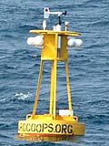
Station 41024 - Sunset Nearshore, NC (SUN2) 
Previous observations
TIME
(EST) |

WDIR
|

WSPD
kts |

GST
kts |

WVHT
ft |

DPD
sec |

APD
sec |

MWD
|

PRES
in |

PTDY
in |

ATMP
°F |

WTMP
°F |

DEWP
°F |

SAL
psu |

VIS
nmi |

TIDE
ft |
| 2026-01-07 09:08 am | SW | 3.9 | 5.8 | - | - | - | - | 29.95 | - | 54.7 | - | 54.0 | - | - | - |
|---|
| 2026-01-07 08:08 am | SW | 3.9 | 5.8 | - | - | - | - | 29.93 | - | 54.9 | - | 54.0 | - | - | - |
|---|
| 2026-01-07 07:08 am | SW | 5.8 | 7.8 | - | - | - | - | 29.92 | - | 54.9 | - | 54.1 | - | - | - |
|---|
| 2026-01-07 06:08 am | SW | 5.8 | 7.8 | - | - | - | - | 29.91 | - | 55.2 | - | 54.3 | - | - | - |
|---|
| 2026-01-07 05:08 am | SW | 5.8 | 7.8 | - | - | - | - | 29.90 | - | 55.6 | - | 54.5 | - | - | - |
|---|
| 2026-01-07 04:08 am | SW | 5.8 | 7.8 | - | - | - | - | 29.90 | - | 55.9 | - | 54.7 | - | - | - |
|---|
| 2026-01-07 03:08 am | SW | 5.8 | 7.8 | - | - | - | - | 29.90 | - | 55.2 | - | 54.1 | - | - | - |
|---|
| 2026-01-07 02:08 am | SW | 5.8 | 7.8 | - | - | - | - | 29.90 | - | 55.0 | - | 54.0 | - | - | - |
|---|
| 2026-01-07 01:08 am | SW | 7.8 | 7.8 | - | - | - | - | 29.88 | - | 55.0 | - | 54.0 | - | - | - |
|---|
| 2026-01-07 12:08 am | SW | 5.8 | 9.7 | - | - | - | - | 29.89 | - | 55.0 | - | 54.0 | - | - | - |
|---|
| 2026-01-06 11:08 pm | SW | 7.8 | 11.7 | - | - | - | - | 29.90 | - | 55.2 | - | 53.8 | - | - | - |
|---|
| 2026-01-06 10:08 pm | SW | 7.8 | 9.7 | - | - | - | - | 29.89 | - | 55.4 | - | 53.8 | - | - | - |
|---|
| 2026-01-06 09:08 pm | SW | 7.8 | 11.7 | - | - | - | - | 29.88 | - | 55.2 | - | 53.6 | - | - | - |
|---|
| 2026-01-06 08:08 pm | SW | 7.8 | 9.7 | - | - | - | - | 29.89 | - | 55.0 | - | 53.6 | - | - | - |
|---|
| 2026-01-06 07:08 pm | SW | 5.8 | 9.7 | - | - | - | - | 29.90 | - | 55.2 | - | 53.6 | - | - | - |
|---|
| 2026-01-06 06:08 pm | SW | 7.8 | 9.7 | - | - | - | - | 29.88 | - | 55.0 | - | 53.8 | - | - | - |
|---|
| 2026-01-06 05:08 pm | SSW | 7.8 | 9.7 | - | - | - | - | 29.87 | - | 55.0 | - | 54.0 | - | - | - |
|---|
| 2026-01-06 04:08 pm | SSW | 7.8 | 9.7 | - | - | - | - | 29.87 | - | 55.4 | - | 54.0 | - | - | - |
|---|
| 2026-01-06 03:08 pm | SSW | 7.8 | 9.7 | - | - | - | - | 29.88 | - | 55.6 | - | 54.5 | - | - | - |
|---|
| 2026-01-06 02:08 pm | SSW | 7.8 | 9.7 | - | - | - | - | 29.88 | - | 55.8 | - | 54.5 | - | - | - |
|---|
| 2026-01-06 01:08 pm | S | 5.8 | 5.8 | - | - | - | - | 29.91 | - | 55.4 | - | 54.9 | - | - | - |
|---|
| 2026-01-06 12:08 pm | SSW | 3.9 | 5.8 | - | - | - | - | 29.95 | - | 54.5 | - | 54.5 | - | - | - |
|---|
| 2026-01-06 11:08 am | SSW | 3.9 | 3.9 | - | - | - | - | 29.99 | - | 53.8 | - | 53.8 | - | - | - |
|---|


