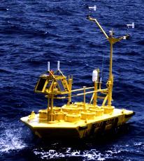
Station 44004 (LLNR 5) - HOTEL 200NM East of Cape May,NJ
No Recent Reports
Links which are specific to this station are listed below:
Data for last 24 hours: No data available.
Data for last 5 days: No data available.
Data for last 45 days: No data available.
- Historical data (data descriptions)
- Standard meteorological data: 1977 1978 1979 1980 1981 1982 1983 1984 1985 1986 1987 1988 1989 1990 1991 1992 1993 1994 1995 1996 1997 1998 1999 2000 2001 2002 2003 2004 2005 2006 2007 2008
- Continuous winds data: 1990 1991 1992 1993 1996 1997 1998 1999 2000 2001 2002 2003 2004 2005 2006 2007 2008
- Spectral wave density data: 1996 1997 1998 1999 2000 2001 2002 2003 2004 2004b 2005 2006 2007 2008
- Search historical meteorological data for observations that meet your threshold conditions
- Climatic summary table (TXT) and plots of (description of tables and plots)
Some data files have been compressed with the GNU gzip program.
The weekly status report and the weekly maintenance report also provide valuable station information.
Note that the payload types and the station locations occasionally change.


