


![]() View the latest observations near East Pacific Tropical Storm Elida.
View the latest observations near East Pacific Tropical Storm Elida.
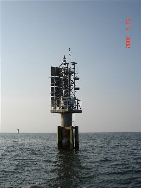
Station GPOM6 - 8744707 - Gulfport Outer Range, MS
Owned and maintained by NOAA's National Ocean Service
Water Level Observation Network
30.230 N 88.982 W (30°13'48" N 88°58'55" W)
Air temp height: 12.7 m above site elevation
Anemometer height: 13.7 m above site elevation
Barometer elevation: 6.1 m above mean sea level
This station was decommissioned as a result of the loss of partner funding for Gulfport PORTS as of NOV 6, 2012. For further information contact the PORTS Program Manager (darren.wright@noaa.gov).
Large icon indicates selected station.
 Stations with recent data
 Stations with no data in last 8 hours
(24 hours for tsunami stations)
(24 hours for tsunami stations)
No Recent Reports
Links which are specific to this station are listed below:
Data for last 45 days: No data available.
- Historical data (data descriptions)
- Search historical meteorological data for observations that meet your threshold conditions
- Climatic summary table (TXT) and plots of (description of tables and plots)
Other Available Historical Data
For data before the dates listed above, go to the National Ocean Service's Meteorological Observations page for this station by clicking here:http://tidesandcurrents.noaa.gov/stationhome.html?id=8744707
Some data files have been compressed with the GNU gzip program.