


![]() View the latest observations near Atlantic Tropical Storm Bertha and East Pacific Hurricane Fausto.
View the latest observations near Atlantic Tropical Storm Bertha and East Pacific Hurricane Fausto.
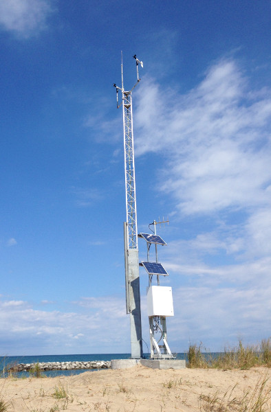
Station EREP1 - 9063038 - Erie
Owned and maintained by NOAA's National Ocean Service
Water Level Observation Network
42.172 N 80.098 W (42°10'19" N 80°5'51" W)
Site elevation: 177 m above mean sea level
Anemometer height: 10.7 m above site elevation
Large icon indicates selected station.
 Stations with recent data
 Stations with no data in last 8 hours
(24 hours for tsunami stations)
(24 hours for tsunami stations)
No Recent Reports
Links which are specific to this station are listed below:
Data for last 45 days: No data available.
- Historical data (data descriptions)
- Search historical meteorological data for observations that meet your threshold conditions
Other Available Historical Data
For data before the dates listed above, go to the National Ocean Service's Meteorological Observations page for this station by clicking here:http://tidesandcurrents.noaa.gov/stationhome.html?id=9063038
Some data files have been compressed with the GNU gzip program.