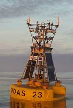
Station 62029 - K1 Buoy 
Data from this station are not quality controlled by NDBC
|
Click on the graph icon in the table below to see a time series plot of the last 24 hours of that observation. | |
| WSW ( 240 deg true ) | |
| 25.1 kts | |
| 28.91 in | |
| 51.3 °F | |
| 53.6 °F | |
| 43.7 °F | |
| 43.9 °F | |
Data from this station are not quality controlled by NDBC


