


![]() View the latest observations near Atlantic Tropical Depression Two, East Pacific Tropical Storm Fausto and East Pacific Tropical Storm Elida.
View the latest observations near Atlantic Tropical Depression Two, East Pacific Tropical Storm Fausto and East Pacific Tropical Storm Elida.
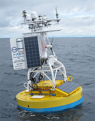
Station 46098 - OOI Waldport Offshore
Station owned and maintained by NSF Ocean Observatories Initiative
Buoy
44.378 N 124.947 W (44°22'42" N 124°56'50" W)
Site elevation: sea level
Air temp height: 4 m above site elevation
Anemometer height: 4.5 m above site elevation
Barometer elevation: 3.95 m above mean sea level
Sea temp depth: 1.15 m below water line
Large icon indicates selected station.
 Stations with recent data
 Stations with no data in last 8 hours
(24 hours for tsunami stations)
(24 hours for tsunami stations)
No Recent Reports
Links which are specific to this station are listed below:
Data for last 45 days: No data available.
- Historical data (data descriptions)
- Search historical meteorological data for observations that meet your threshold conditions
Some data files have been compressed with the GNU gzip program.