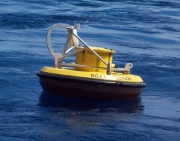
Station 21417 - 290NM SE of the Kuril Islands
Data Access
Links which are specific to this station are listed below:
Real Time Data in tabular form for the last forty-five days.
Historical Data & Climatic Summaries for quality controlled data for prior months and years.
The weekly maintenance report also provides valuable station information.
Note that the payload types and the station locations occasionally change.


