


Does NDBC measure ocean current velocities?
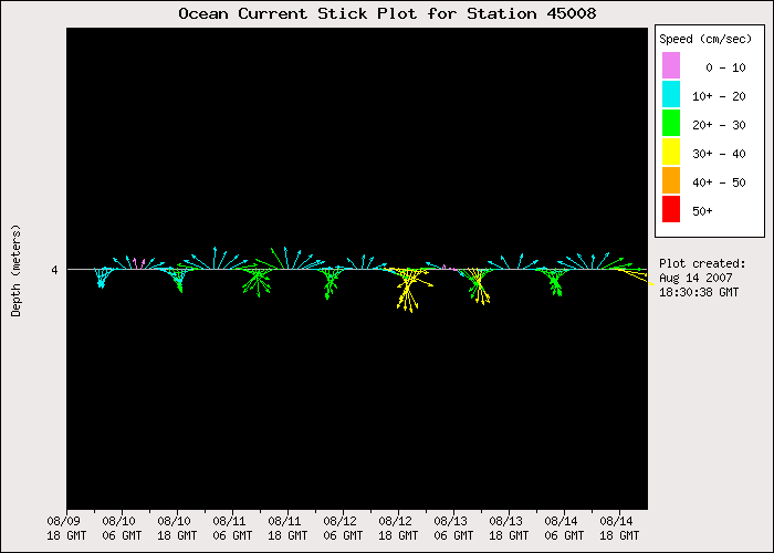
NDBC measures ocean current velocities at a number of stations, using several acoustic Doppler systems. At some stations, current speed and direction from a single depth near the surface are collected, quality-controlled, and displayed. One-, 3-, and 5-day stick plots of the data are available as are the digital data.
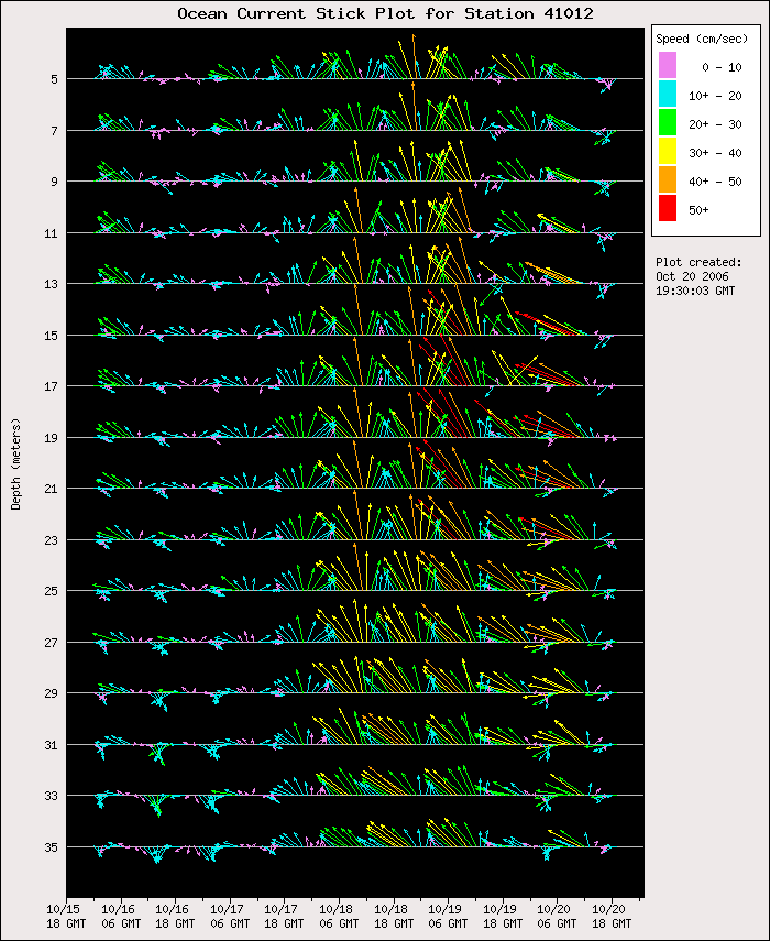
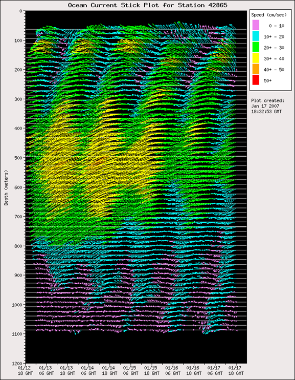
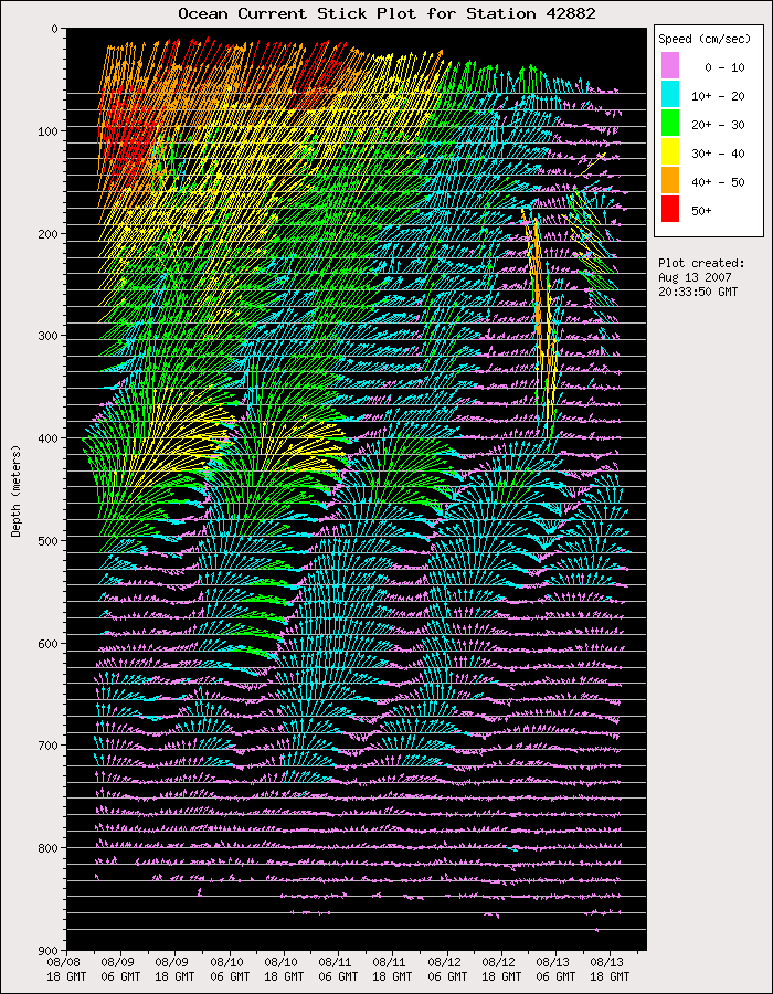
At other stations, NDBC collects data as a depth profile - some as deep as 300 meters (984 feet). Up to 20 distinct depths may be sampled. In deeper water, the currents may be sampled at 8 or 16 meter intervals. In shallow water, depth intervals of 1-, 2-, or 4-meters are used. In order to insure that quality data are collected, NDBC samples at 1 to 3 second intervals over a period of 5 to 6 minutes and averages the data into a single representative speed and direction. The profiles of data are available as 1-, 3-, and 5-day stick plots and as digital data.
NDBC also collects, quality controls, and displays current profile data from several equatorial sites in the central Pacific Ocean. These data are not available in real-time, but are displayed on the TAO web page as soon as they are processed following sensor collection.
NDBC has been involved in a project to acquire, quality-control, and display current profile data from a number of oil and gas production platforms and drilling rigs in the northern Gulf of Mexico (link to website). The data are collected by the oil companies and passed to NDBC. The quality-controlled data are available from the Oil and Gas Industry ADCP portion of NDBC's website, along with the quality flags derived from the quality-control process. These data are also presented as 1-, 3-, and 5-day stick plots.
NDBC also serves ocean current data from Integrated Ocean Observing System (IOOS®) partners.