


Deep-ocean Assessment and Reporting of Tsunamis (DART)
DART Prototype Test Deployment
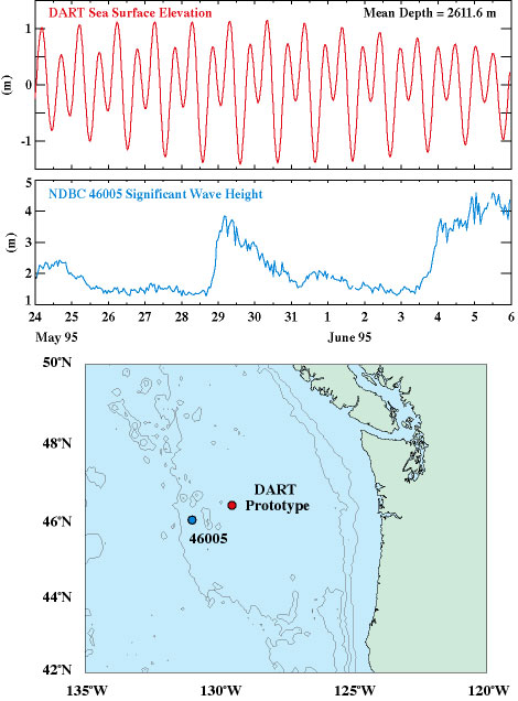
A test deployment of a prototype DART system was carried out from 23 May to 19 July 1995 off the Washington-Oregon coast in 2611 m of water [Milburn, et al., 1996]. The system proved to be quite robust, achieving a data return rate of 95%. No loss of data was attributable to high winds and waves, in spite of significant wave heights that exceeded 6 m, as recorded on 11 June by the NOAA NDBC data buoy located 70 km east of the mooring. An initial 6-station array has been deployed.
Courtesy of PMEL
Gonzalez, F.I., H.M. Milburn, E.N. Bernard and J.C. Newman(1998):
Deep-ocean Assessment and Reporting of Tsunamis (DART):
Brief Overview and Status Report. In Proceedings of the
International Workshop on Tsunami Disaster Mitigation,
19-22 January 1998, Tokyo, Japan.